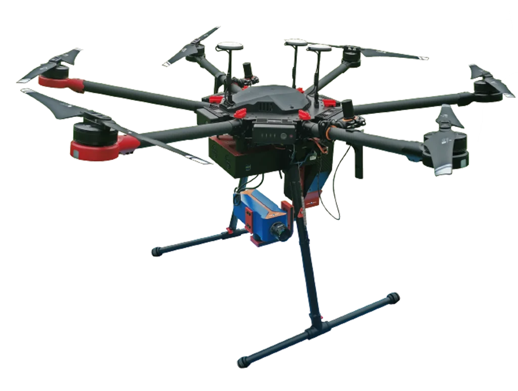
UAV Hyperspectral Imaging Configurations
LiSen Optics iSpecHyper UAV hyperspectral imaging systems support visible, near-infrared and short-wave infrared measurements through different payload configurations. Mini100 and VM100-Pro provide 400–1000 nm VNIR imaging, while VM400 and VM500 offer SWIR coverage. Calibration targets and analysis workflows support acquisition and processing across the range.
iSpecHyper-Mini100: 400–1000 nm Standard Configuration
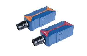
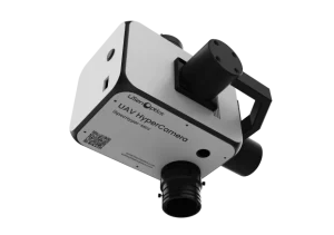
The iSpecHyper-Mini100 combines a CMOS hyperspectral camera, stabilized gimbal, onboard acquisition and power modules for DJI UAV platforms, including the M350 RTK. It covers 400–1000 nm with spectral resolution of ≤3.0 nm at 4× configuration, 300 spectral channels and 480 spatial channels at 4×. Full-spectrum acquisition runs at 50 fps.
The standard configuration includes an N100 CPU, 8 GB RAM, 512 GB storage and a 5 MP auxiliary camera. The two-axis, dual-motor gimbal has a specified stabilization accuracy of 0.1°. RTK-supported positioning accuracy is 1.5 cm. Weight is below 2 kg and power consumption is approximately 30 W.
iSpecHyper-VM100-Pro: 400–1000 nm Advanced Configuration
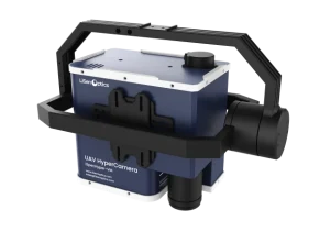
The iSpecHyper-VM100-Pro also covers 400–1000 nm with a CMOS detector and 50 fps full-spectrum acquisition. Spectral resolution is ≤2.5 nm at 4× configuration. Spatial channels are adjustable: 1920 at 1×, 960 at 2× or 480 at 4×.
The advanced configuration includes an i7 CPU, 16 GB RAM, 1 TB storage and a 15 MP auxiliary camera. Gimbal stabilization accuracy is 0.08°, RTK-supported positioning accuracy is 1.5 cm and IMU attitude-angle accuracy is 0.01°. Weight is below 2.7 kg and power consumption is approximately 35 W.
Both VNIR configurations offer a choice of 16 mm, 25 mm or 35 mm lenses. Their external-scanning and stabilization design reduces vibration-related distortion and blur during pushbroom acquisition. The optical design provides a wide field of view and a stated spot diameter below 0.5 pixel. The comparison table retains the 4× and adjustable-channel qualifications for each model.
iSpecHyper-VM400: 900–1700 nm
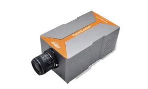
The LiSen Optics iSpecHyper-VM400 is a compact airborne hyperspectral imaging system designed for integration with DJI multirotor UAV platforms. It combines a hyperspectral imager, stabilized gimbal, airborne control and data-acquisition module, and onboard power supply.
A proprietary architecture for internal or external scanning and stabilization reduces motion-induced artifacts associated with pushbroom imaging on small UAVs. The custom gimbal helps minimize distortion and blur during flight, supporting fine spectral resolution and consistent image quality.
The system supports deployment on multiple UAV platforms for agriculture, forestry, water and environmental monitoring, precision agriculture, research, target identification, and camouflage-material analysis. Modular accessories and customization options provide flexibility for research and field work.
iSpecHyper-VM500: 900–2500 nm
The iSpecHyper-VM500 uses a Stirling-cooled HgCdTe detector for 900–2500 nm imaging, with spectral resolution better than 10 nm, at least 400 spectral bands, and a maximum frame rate of at least 100 fps. The standard hyperspectral lens has a 25 mm focal length.
iSpecHyper-VM500-VNIR and Combined Imaging
The CMOS-based VNIR channel covers 400–1000 nm with 300 spectral bands and spectral resolution better than 2.8 nm. When combined with the VM500 SWIR channel, the specified system range is 400–2500 nm, with at least 640 combined spectral bands and 640 combined spatial pixels. Channel-specific and combined-system figures are listed separately in the comparison table.
The VM500 supports integration with multiple UAV platforms, RTK-based georeferencing, and airborne or ground-based deployment. USB Type-C expansion supports USB 3.0 transfer rates up to 350 MB/s. ELS-series irradiance sensors support ambient-light calibration. The analysis workflow also includes automated data fusion, deep-learning model training and prediction, and vector-file export.
Model Features and Acquisition Workflows
- Model-specific spectral coverage. Mini100 and VM100-Pro cover 400–1000 nm, with respective spectral resolutions of ≤3.0 nm and ≤2.5 nm at 4× configuration. VM400 covers 900–1700 nm at <6 nm resolution. VM500 covers 900–2500 nm at better than 10 nm resolution. The separate VM500-VNIR channel supports a combined 400–2500 nm configuration with VM500.
- Detector configurations. Mini100, VM100-Pro and the VM500-VNIR channel use CMOS. VM400 uses TE-cooled InGaAs and VM500 uses Stirling-cooled HgCdTe. Detector and acquisition specifications are model-specific.
- Optics across the full field. The optical design combines fine spectral resolution, a wide field of view, and consistent image quality across the sensor area.
- Automated reflectance measurement. Automatic calibration-target recognition, real-time reflectance calculation, and dynamic target-spectrum identification support measurement workflows.
- Live target classification. Software classifies ground targets by spectral reflectance and displays color-coded distribution maps for land-cover and material identification.
- GPS-synchronized acquisition. RGB imagery is synchronized with GPS data. Operators can monitor sampling points, plan flight paths, acquire data point by point, preview results, and apply corrections.
- Auxiliary scene monitoring. Mini100 has a 5 MP auxiliary camera; VM100-Pro and VM400 specify 15 MP cameras. Live scene monitoring is combined with real-time hyperspectral images and spectral curves, with single-band, true-color and false-color views.
- Intelligent camera control. Acquisition control includes automatic exposure, scan-speed synchronization, auxiliary-camera operation, remote control, cruise mode, and INS-assisted acquisition.
- Vegetation-index analysis. The software calculates more than 20 common indices, including NDVI, RVI, EVI, ARVI, mSR705, VOG, and PRI, from suitable input bands. User-defined algorithms are supported without third-party software.
- ENVI-compatible data. Exported data are compatible with ENVI and other hyperspectral analysis software.
Scroll horizontally to compare all five model and channel columns. Mini100 and VM100-Pro are complete VNIR configurations; VM500-VNIR is the VNIR channel of the combined VM500 system.
Technical Specifications
| Parameter | iSpecHyper-Mini100 | iSpecHyper-VM100-Pro | iSpecHyper-VM400 | iSpecHyper-VM500 | iSpecHyper-VM500-VNIR |
|---|---|---|---|---|---|
| Product Image |
 |
 |
 |
|
|
| Spectral Range | 400–1000 nm | 400–1000 nm | 900–1700 nm | 900–2500 nm | 400–1000 nm |
| Spectral Resolution | ≤3.0 nm (4×) | ≤2.5 nm (4×) | <6 nm | Better than 10 nm | Better than 2.8 nm |
| Spatial Resolution | 0.71 mrad @ f=35 mm | 0.71 mrad @ f=35 mm | 0.85 mrad @ f=35 mm | Not specified | Not specified |
| Field of View (FOV) | 15.6° @ f=35 mm | 15.6° @ f=35 mm | 15.6° @ f=35 mm | 21.8° @ f = 25 mm | 21° @ f = 25 mm |
| Spatial Channels | 480 (4×) | 1920 (1×), 960 (2×), 480 (4×), adjustable | 640 | 640 | 1920 |
| Spectral Bands | 300 (4×) | 300 (4×) | 400 | ≥400 | 300 |
| Detector | CMOS | CMOS | TE-cooled InGaAs | HgCdTe (Stirling-cooled) | CMOS |
| Detector Interface | USB 3.0 | USB 3.0 | USB 3.0 | Gigabit Ethernet | USB 3.0 |
| Sensor Format | 1/1.2" | 1/1.2" | Not specified | Not specified | Not specified |
| Detector Active Area | 11.3 × 7.1 mm | 11.3 × 7.1 mm | 9.6 × 7.68 mm | 9.6 mm × 7.68 mm | 11.3 mm × 7.1 mm |
| Native Detector Resolution | 1920 × 1200 | 1920 × 1200 | 640 × 512 | 640 × 512 | Not specified |
| Pixel Size | 5.86 × 5.86 µm | 5.86 × 5.86 µm | 5 × 5 µm | 15 µm × 15 µm | 5.86 µm × 5.86 µm |
| Pixel Depth | 12-bit | 12-bit | 12 bits | 12-bit | 12-bit |
| Frame Rate | 50 fps, full-spectrum acquisition | 50 fps, full-spectrum acquisition | Up to 125 fps, full-spectrum acquisition | ≥100 fps | 128 fps |
| Lens Focal Length | 16 mm / 25 mm / 35 mm, selectable | 16 mm / 25 mm / 35 mm, selectable | Standard: 16 mm | 25 mm focal length (standard) | Not specified |
| Auxiliary HD Camera | 5 MP | 15 MP | 15 MP | Not specified | Not specified |
| Stabilization System | 2-axis, 2-motor; stabilization accuracy: 0.1° | 2-axis, 2-motor; stabilization accuracy: 0.08° | High-stability two-axis, dual-motor gimbal; stabilization accuracy: 0.08° | Not specified | Not specified |
| Airborne Data Acquisition System | CPU: N100; RAM: 8 GB; storage: 512 GB | CPU: i7; RAM: 16 GB; storage: 1 TB | CPU: Intel Core i7; RAM: 16 GB; Storage: 1 TB | Not specified | Not specified |
| Remote Control System (with Ground Station) | Not specified | Not specified | Live spectral/imagery display and remote intelligent control | Not specified | Not specified |
| Navigation System | GPS: RTK supported; positioning accuracy: 1.5 cm; IMU attitude-angle accuracy: N/A | GPS: RTK supported; positioning accuracy: 1.5 cm; IMU attitude-angle accuracy: 0.01° | GPS with RTK; positioning accuracy: 10 cm | Not specified | Not specified |
| Weight | <2 kg | <2.7 kg | Approx. 3 kg | Not specified | Not specified |
| Power Consumption | Approx. 30 W | Approx. 35 W | Approx. 50 W | Not specified | Not specified |
| Airborne Acquisition & Control Software | Basic: acquisition control and real-time preview of hyperspectral images and spectral curves | Professional: acquisition control, real-time preview of hyperspectral images and spectral curves, and real-time parameter retrieval on a PC | Professional Edition: acquisition control, real-time hyperspectral image and spectrum preview, live parameter retrieval, and more | Not specified | Not specified |
| Ground-Station Remote-Control Software | Not specified | Not specified | Remote intelligent control | Not specified | Not specified |
| Hyperspectral Data Preprocessing and Analysis Software | Basic | Professional | Professional Edition | Not specified | Not specified |
| Accessories | Illuminance meter, reflectance target, portable carrying case, and documentation USB drive | Illuminance meter, reflectance target, portable carrying case, and documentation USB drive | Wireless keyboard and mouse; documentation USB drive, and related accessories | Not specified | Not specified |
| F-number | Not specified | Not specified | Not specified | F/2.0 | F/2.6 |
| Detector Power / Supply | Not specified | Not specified | Not specified | 24 V DC | 12 V DC, 4.3 W |
| Slit Length | Not specified | Not specified | Not specified | 9.6 mm | 11.3 mm |
| Slit Width | Not specified | Not specified | Not specified | 30 µm | 25 µm |
| Recommended Binning | Not specified | Not specified | Not specified | 1 × 1 | 1 × 1 |
| Spectral Dispersion | Not specified | Not specified | Not specified | Not specified | Transmission grating |
| Combined Spectral Range | Not specified | Not specified | Not specified | Not specified | 400–2500 nm |
| Combined Spectral Bands | Not specified | Not specified | Not specified | Not specified | ≥640 |
| Combined Spatial Pixels | Not specified | Not specified | Not specified | Not specified | 640 |
| Combined FOV | Not specified | Not specified | Not specified | Not specified | 21° @ f = 25 mm |
| Instantaneous Field of View (IFOV) | Not specified | Not specified | Not specified | 1.2 mrad @ f = 25 mm | 1 mrad @ f = 25 mm |
| Combined IFOV | Not specified | Not specified | Not specified | Not specified | 1 mrad @ f = 25 mm |
| System Expansion Interface | Not specified | Not specified | Not specified | USB Type-C (system expansion) | USB Type-C (system expansion) |
| USB 3.0 Transfer Rate | Not specified | Not specified | Not specified | Up to 350 MB/s (system expansion) | Up to 350 MB/s (system expansion) |
| UAV Calibration Target Size | 1.2 m × 1.2 m | 1.2 m × 1.2 m | 1.2 m × 1.2 m | 1.2 m × 1.2 m | 1.2 m × 1.2 m |
| Calibration Reference Panel Spectral Range | 250–2500 nm | 250–2500 nm | 250–2500 nm | 250–2500 nm | 250–2500 nm |
| Calibration Reference Panel Reflectance Levels | 3%, 5%, 10%, 20%, 30%, 40%, 50%, 60%, 70%, 80%, and ≥98%; factory-traceable calibration report included | 3%, 5%, 10%, 20%, 30%, 40%, 50%, 60%, 70%, 80%, and ≥98%; factory-traceable calibration report included | 3%, 5%, 10%, 20%, 30%, 40%, 50%, 60%, 70%, 80%, and ≥98%; factory-traceable calibration report included | 3%, 5%, 10%, 20%, 30%, 40%, 50%, 60%, 70%, 80%, and ≥98%; factory-traceable calibration report included | 3%, 5%, 10%, 20%, 30%, 40%, 50%, 60%, 70%, 80%, and ≥98%; factory-traceable calibration report included |
| Calibration Reference Panel Dimensions | 500 × 500 mm | 500 × 500 mm | 500 × 500 mm | 500 × 500 mm | 500 × 500 mm |
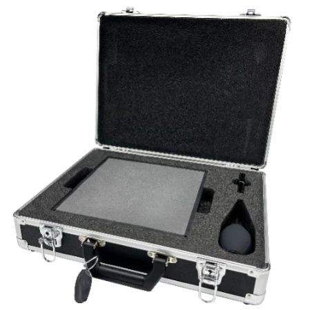
| Calibration Reference Panel Accessories | Rugged portable case, PET dust protection, and cleaning kit | Rugged portable case, PET dust protection, and cleaning kit | Rugged portable case, PET dust protection, and cleaning kit | Rugged portable case, PET dust protection, and cleaning kit | Rugged portable case, PET dust protection, and cleaning kit |
VM500-VNIR lists the VNIR channel. Rows labeled “Combined” describe the VM500 SWIR-plus-VNIR configuration. “Not specified” means no value was provided for that model or channel. Calibration-target and reference-panel specifications are shared accessory data, rather than camera spectral limits. Product views illustrate the UAV platform and may vary with configuration.
System Configuration and Product Photos
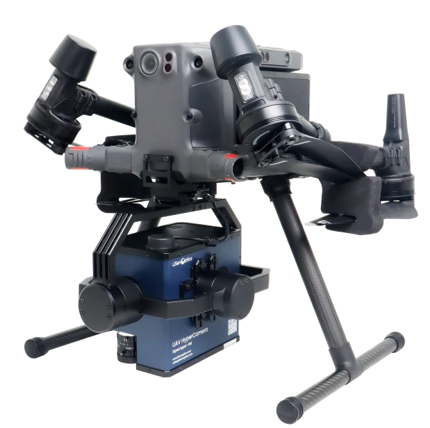
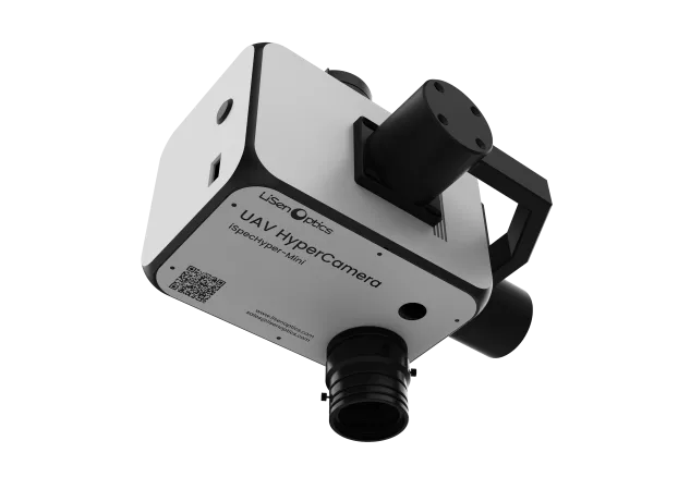
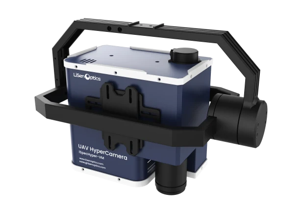
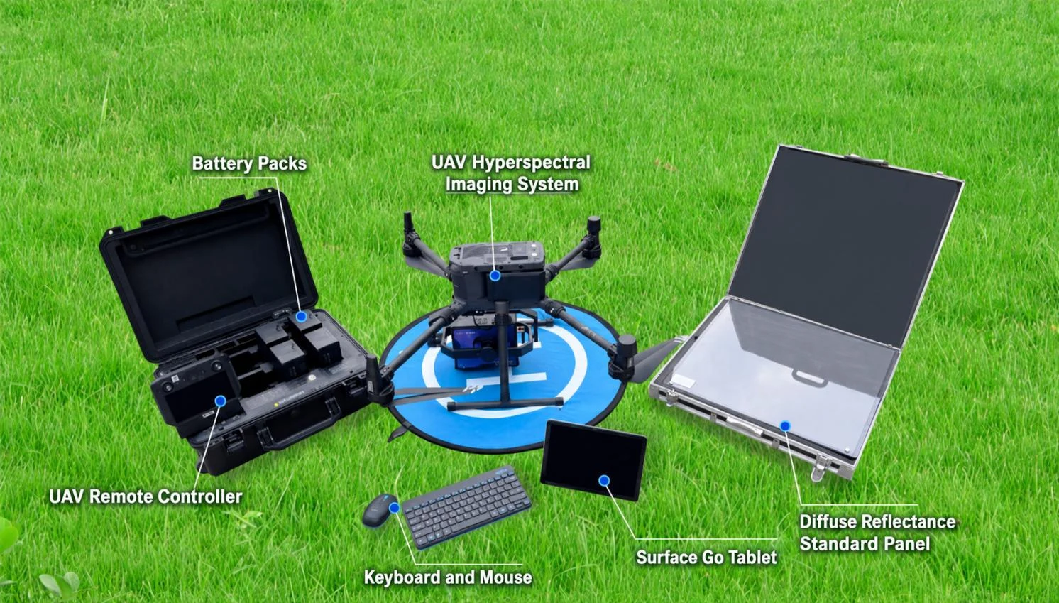
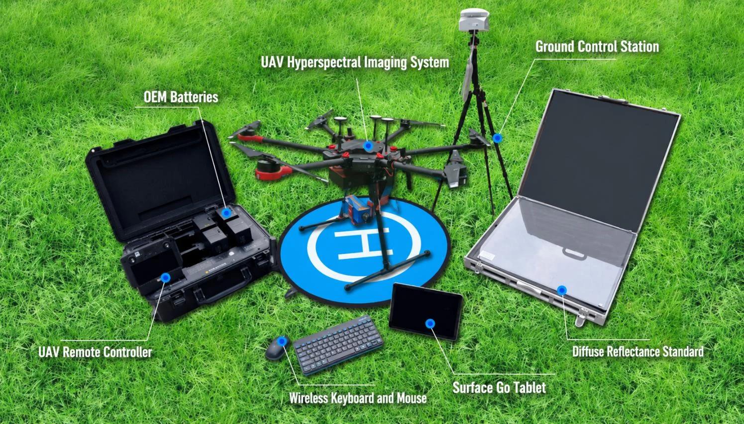
Mini100 and VM100-Pro Payloads and UAV Platform
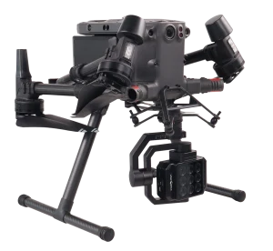
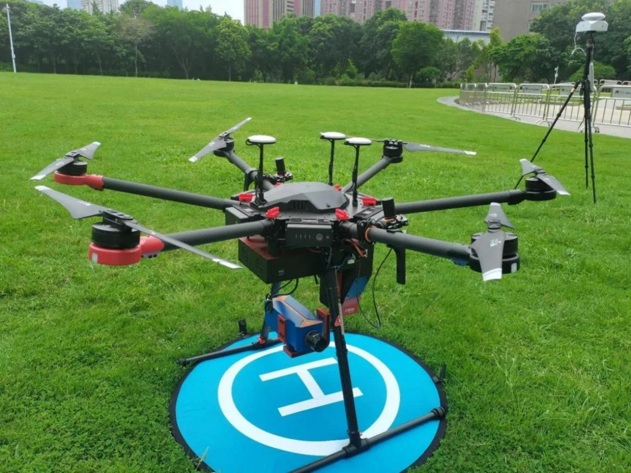
The product views below show the VNIR platform and its standard and advanced payload configurations. Supplied equipment depends on the selected configuration.
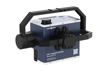
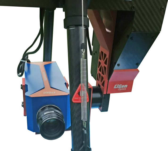
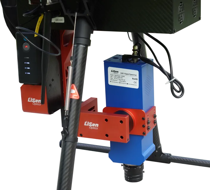
VM Series Platform Views
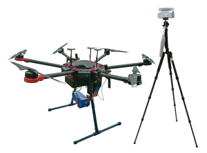
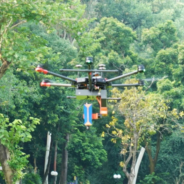
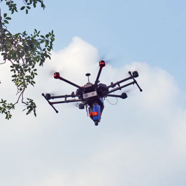
The photographs show the VM400 reference configuration and shared UAV-platform examples. Hardware details depend on the selected spectral configuration.
Calibration Targets and Reference Panels
UAV calibration targets support reflectance measurements in the field. The following plots show the spectral reflectance of 1.2 m × 1.2 m targets, with examples of black-and-white and multi-level target layouts.
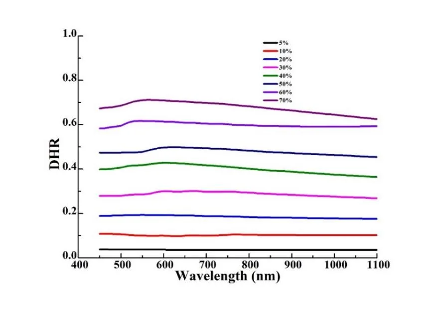
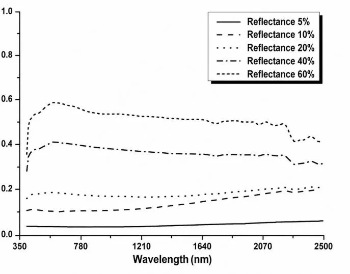
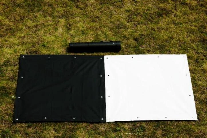
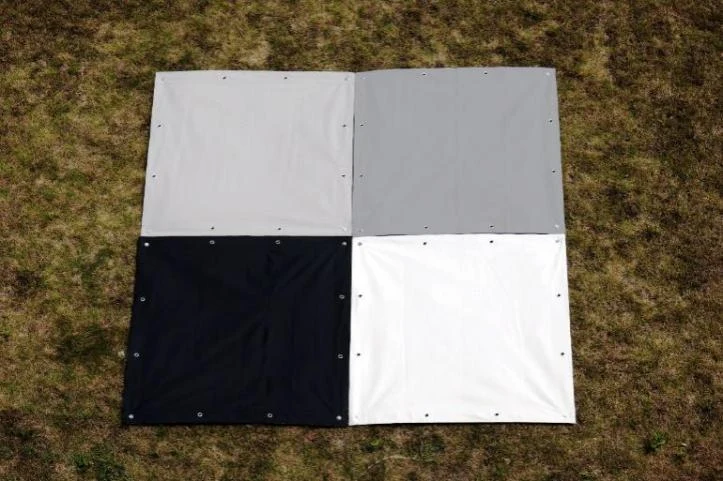
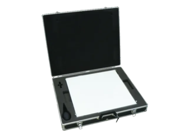
The UAV calibration reference panel covers 250–2500 nm and measures 500 × 500 mm. Available reflectance levels are 3%, 5%, 10%, 20%, 30%, 40%, 50%, 60%, 70%, 80%, and ≥98%. A factory-traceable calibration report, rugged portable case, PET dust protection, and cleaning kit are included.
Airborne Control and Data Acquisition Software
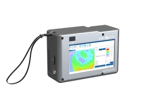
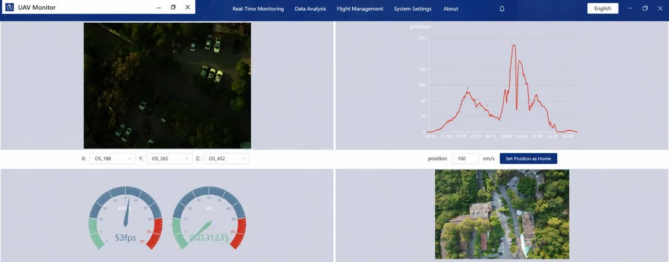
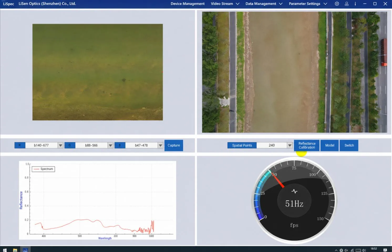
The professional airborne-control software provides live previews of hyperspectral imagery and spectra, live parameter retrieval, GPS-synchronized triggering, and RGB image geotagging. Controls include data acquisition, automatic exposure, automatic scan-speed matching, auxiliary-camera operation, remote control, cruise acquisition, and INS-assisted acquisition.
For VM400 deployments, the DJI remote controller and ground data platform let operators view live spectral imagery, track sampling points, and preview planned flight lines. The auxiliary camera provides visual feedback while hyperspectral images and spectral curves update in real time.
PC software supports single-band, true-color, and false-color views, automatic calibration-target recognition, reflectance calculation, and dynamic spectral mapping of ground-target classes. Data are compatible with ENVI and other mainstream remote-sensing software.
The interface examples illustrate software display and analysis tools. Hardware ranges are model-specific: 900–1700 nm for VM400, 900–2500 nm for VM500, and 400–2500 nm for the combined VM500 SWIR-plus-VNIR configuration. Example datasets may show other spectral ranges.
Water-Quality Workflows and Analysis
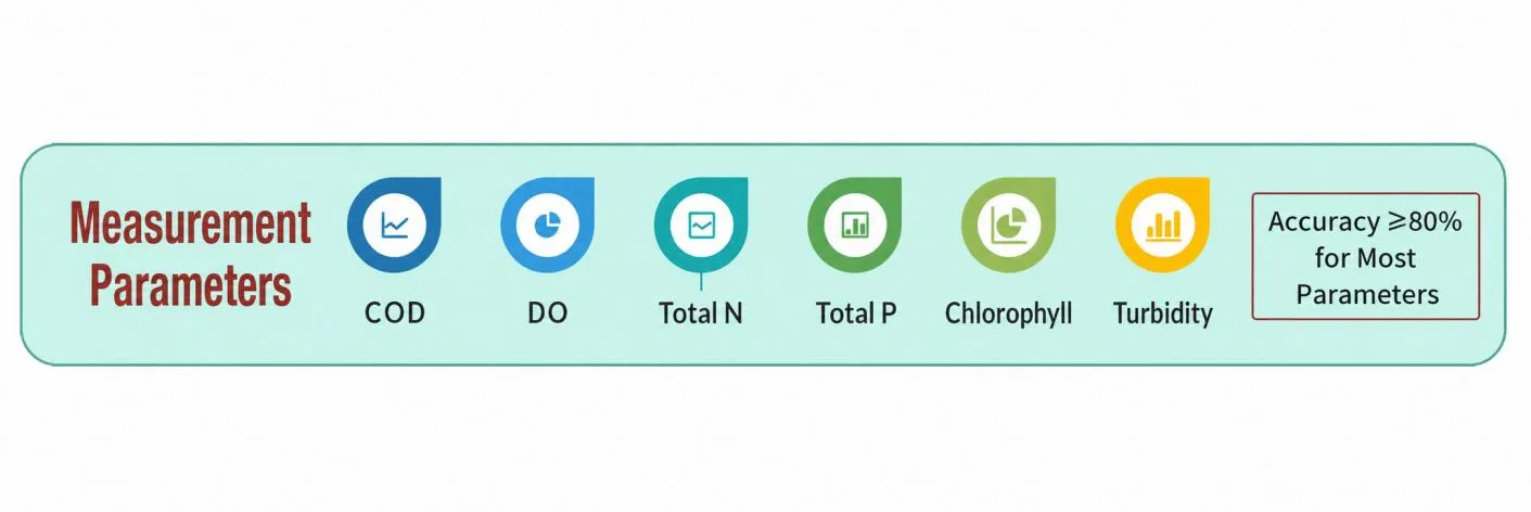
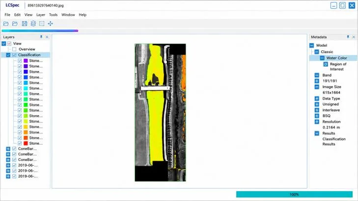
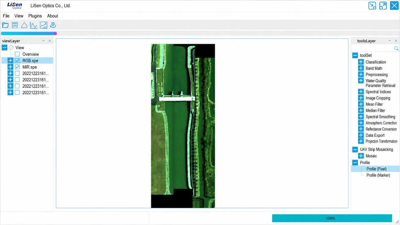
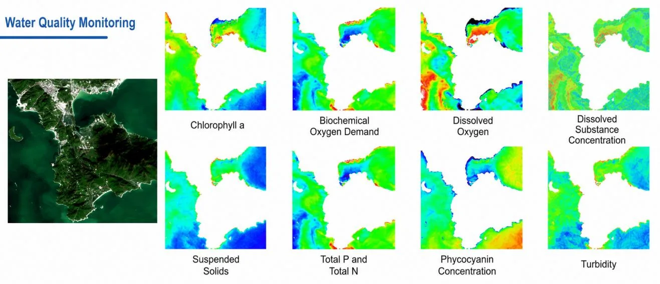
LiSen Optics provides an integrated air-ground-water hyperspectral monitoring solution that combines UAV, fixed-site, surface, and underwater platforms. Quantitative retrieval models support real-time monitoring of total nitrogen, total phosphorus, chlorophyll, ammonia nitrogen, turbidity, and permanganate index (CODMn), among other water-quality parameters.
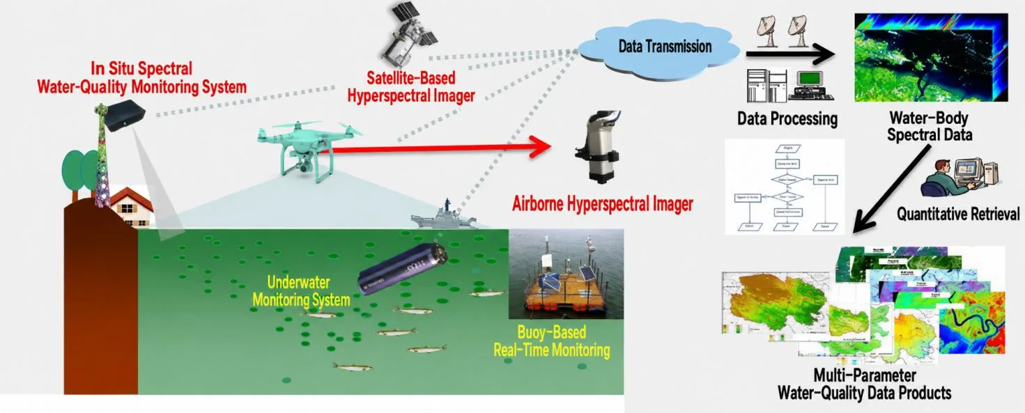
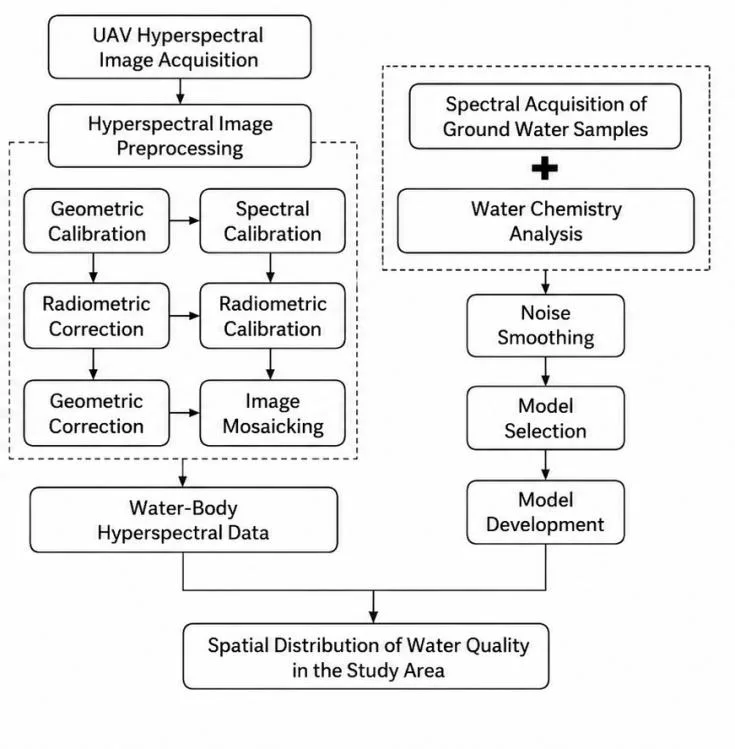
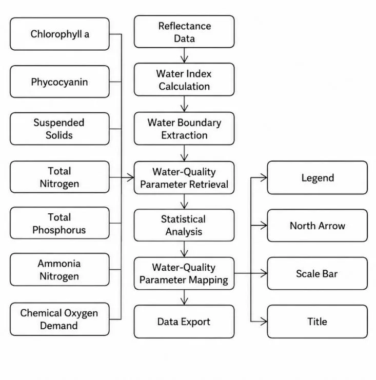
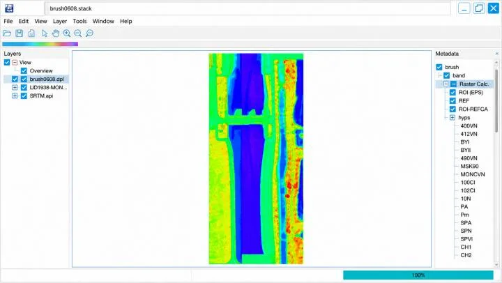
The water-quality quick-look module supports image viewing, water-body extraction, parameter retrieval, statistical analysis, and thematic mapping. Processed reflectance data can be imported directly. Water indices extract water boundaries, while retrieval models estimate chlorophyll-a, suspended solids, total nitrogen, total phosphorus, ammonia nitrogen, and chemical oxygen demand (COD).
Results can be exported and displayed as color-coded concentration maps. Reported accuracy is >80% for most indicators.
Software Edition Comparison
Mini100 is specified with basic acquisition-control and preprocessing software. VM100-Pro includes professional acquisition control with PC-based real-time parameter retrieval and professional preprocessing and analysis software. The table below compares the LiSpecView software editions; water-quality retrieval and geometric correction depend on the selected edition.
LiSpecView-Hyper provides the basic preprocessing and analysis tools. LiSpecView-Hyper-WQ adds water-quality retrieval, while LiSpecView-Hyper-WQ-PRO also provides UAV geometric correction and projection transformation.
| Capability | LiSpecView-Hyper(Basic Edition) | LiSpecView-Hyper-WQ(Basic + Water Quality) | LiSpecView-Hyper-WQ-PRO(Professional Edition) |
|---|---|---|---|
| View spectral and image data; calculate reflectance; apply radiometric correction, filtering, dark-background subtraction, spectral and spatial denoising, mask export, and image crop/rotate/flip operations – no third-party software required. | √ | √ | √ |
| Mosaic multiple hyperspectral flight lines without GPS data, with built-in seamline balancing and manual seam adjustment – no third-party software required. | √ | √ | √ |
| Calculate common vegetation indices without third-party software, including NDVI, RVI, EVI, ARVI, NDVI705, mSR705, mNDVI705, VOG1/2/3, PRI, SIPI, NDNI, PSRI, CRI1, CRI2, ARI1, ARI2, WBI, NDWI, MSI, NDII, NDLI, and CAI. | √ | √ | √ |
| Built-in hyperspectral analysis tools, including Spectral Angle Mapper (SAM), support user-trained supervised classification, custom model input, and user-defined band math. | √ | √ | √ |
| Retrieve water-quality parameters including chlorophyll, total nitrogen, total phosphorus, ammonia nitrogen, permanganate index, suspended solids, and dissolved oxygen – no third-party software required. | × | √ | √ |
| Geometric correction for UAV hyperspectral data removes distortion and applies projection transformation to generate georeferenced hyperspectral datasets. | × | × | √ |
Typical Applications
Applications include vegetation and crop-health research, forest-canopy studies, forestry science, environmental and agricultural monitoring, water and climate research, ecology, nitrogen and leaf-chlorophyll measurement, soil analysis, biomass research, and marine monitoring.
Depending on the selected wavelength configuration, further applications include plastics sorting, infrared target recognition, fluorescence hyperspectral imaging, food-safety inspection, and fruit and vegetable sorting.


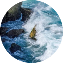
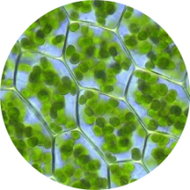

The examples below illustrate hyperspectral imaging methods across different wavelength ranges. Select the appropriate channel or configuration for the required input bands. Visible-band examples require VNIR coverage; VM400 is specified at 900–1700 nm and VM500 at 900–2500 nm.
Agriculture and Crop Health
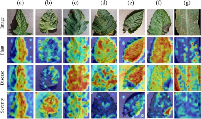
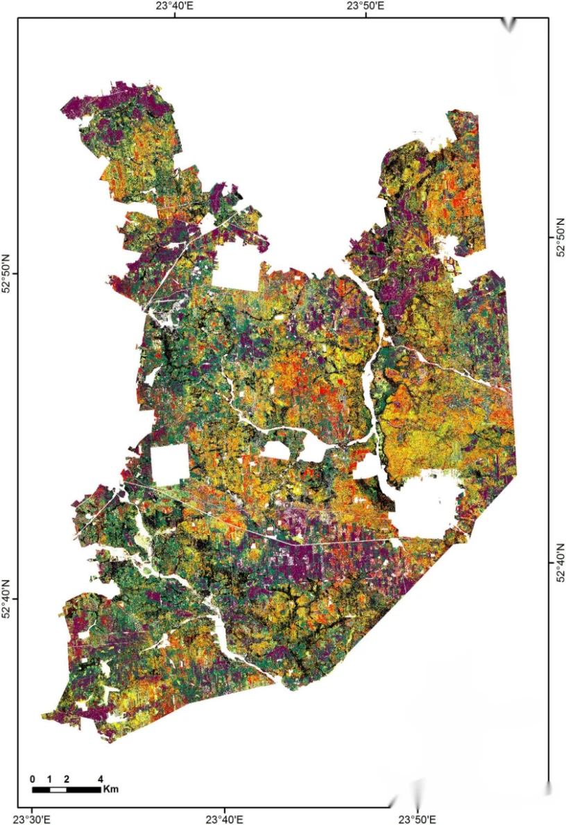
Hyperspectral imagery supports assessment of crop health, growth, and pest or disease stress by detecting spectral changes associated with yellowing, wilting, and other physiological responses. Comparing healthy and affected plants helps identify the type and severity of stress.
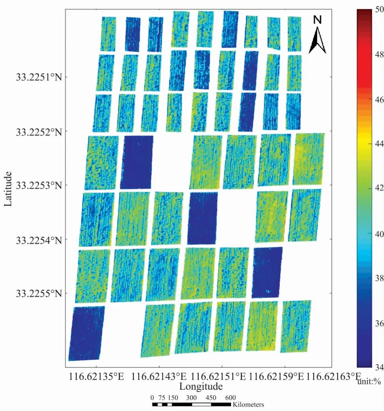
For crop nutrient monitoring, hyperspectral remote sensing provides rapid, spatially resolved measurements. Compared with multispectral systems, the greater number of bands and finer spectral resolution capture wavelength-specific crop responses, supporting timely diagnosis and nutrient-management decisions.
Forestry and Tree Species Identification
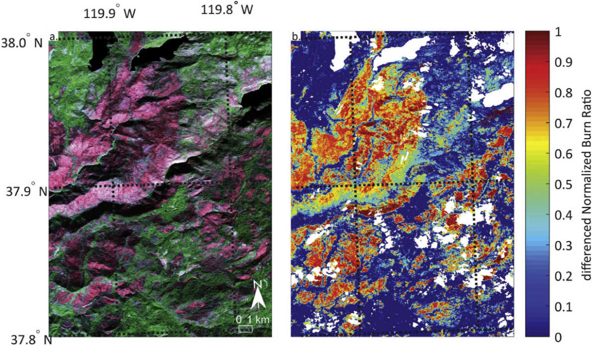
Vegetation-cover and soil-related indices can help detect forest fires and assess burn severity, supporting evaluation across large areas.
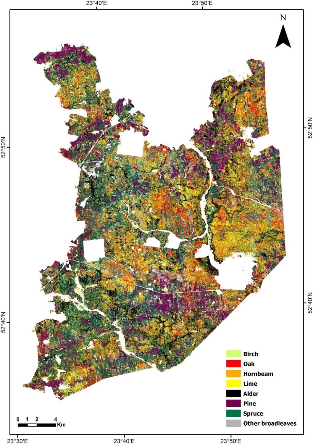
Continuous spectral information captures subtle differences among leaves, bark, and canopy tissues. Processing diagnostic features across bands supports algorithm-based tree-species mapping, including species with similar appearance.
Water-Environment Monitoring
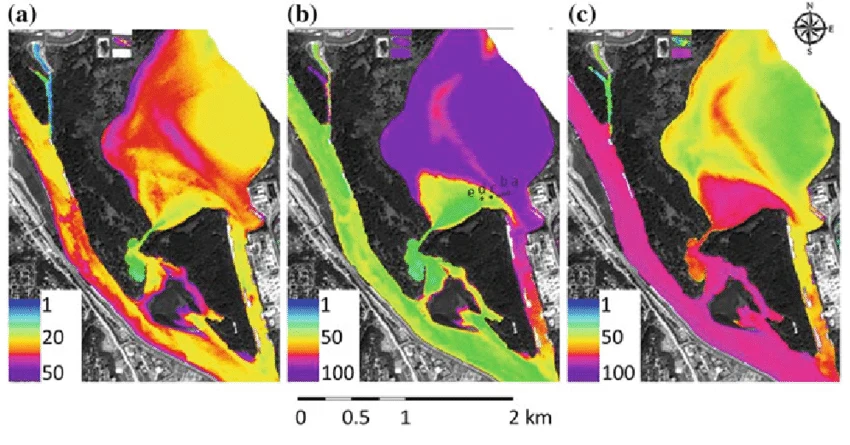
High-resolution hyperspectral remote sensing can identify and estimate chlorophyll, tannic compounds, and suspended or sedimentary matter. These measurements support algae monitoring and assessment of plankton distribution and potential fish aggregation areas.
In general hyperspectral measurements, chlorophyll shows strong absorption in the blue (400–500 nm) and red (600–700 nm) regions, with higher reflectance in the near-infrared (700–750 nm). These features support chlorophyll-concentration estimates and assessment of trophic conditions and algal blooms.
Mineral Identification and Geological Exploration
Hyperspectral remote sensing supports surface-mineral identification, particularly hydrothermal-alteration mapping, and is widely used in geochemical and geological mapping. Diagnostic responses associated with mineral composition provide detailed mineralogical information.
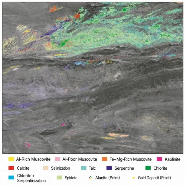
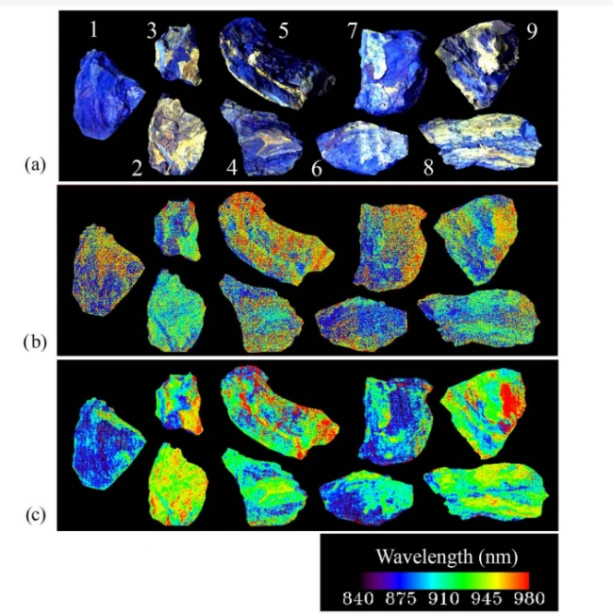
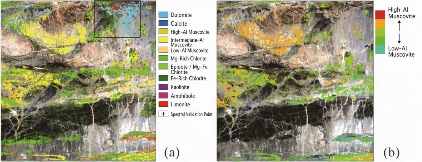
Regional mineral mapping combines diagnostic spectra with spatial imagery to identify alteration minerals and map their location, extent, morphology, and distribution. Geological hyperspectral methods support exploration of kimberlite, carbonatite-hosted rare-earth, porphyry, epithermal, and skarn deposits. Alteration-mineral distributions can also help interpret hydrothermal-fluid properties, migration, and the evolution of mineralizing systems.
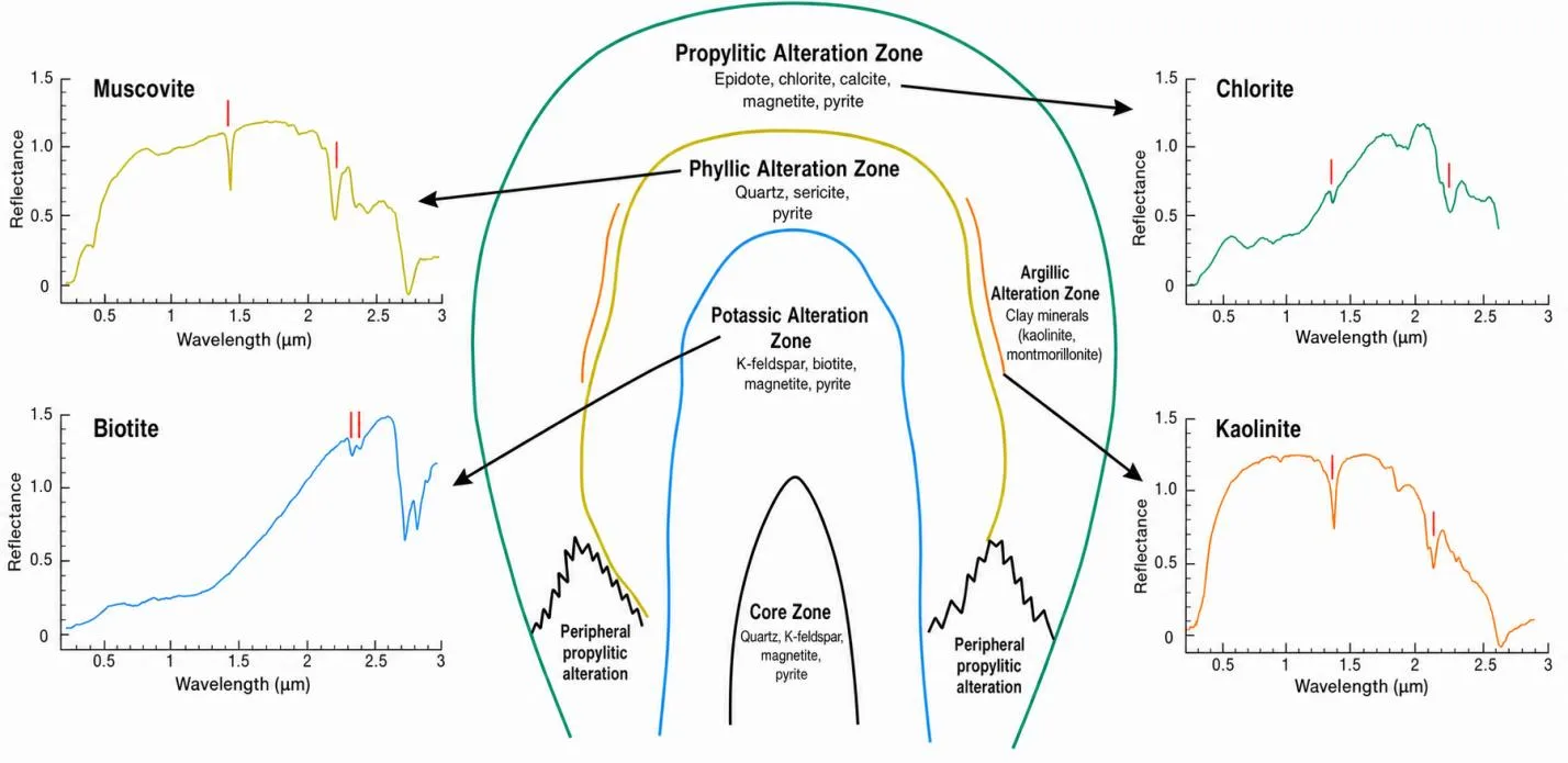
Research illustration includes reference wavelengths extending to 3 µm; instrument coverage is defined by the selected configuration.
Mineral-chemistry retrieval extends the analysis of spectral features to relationships among mineral composition, crystal structure, and formation conditions. Reference laboratory spectra can support interpretation of geological origin and processes associated with petrogenesis, mineralization, and metamorphism.
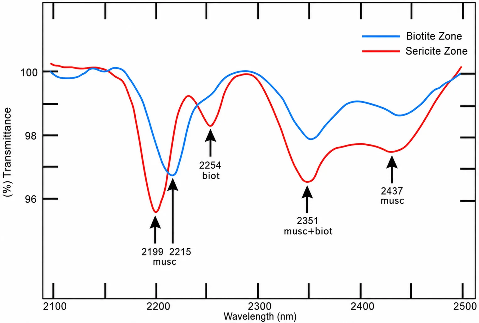
Reference laboratory spectrum; the original transmittance axis, zone labels, curves, and wavelength annotations are retained.
Defense and Camouflage-Material Identification
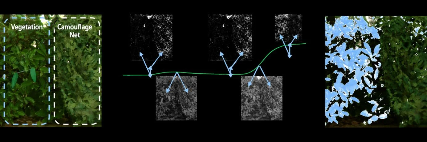
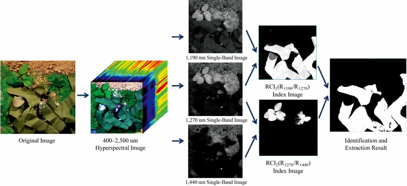
Differences between target and camouflage spectral signatures can help detect concealed objects and characterize camouflage materials. In defense reconnaissance and inspection, spectral information supports assessment of material composition and target presence. SWIR hyperspectral imaging can also help distinguish camouflage nets in field environments.
Field Deployment Examples
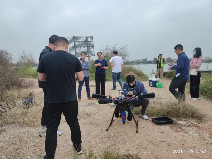
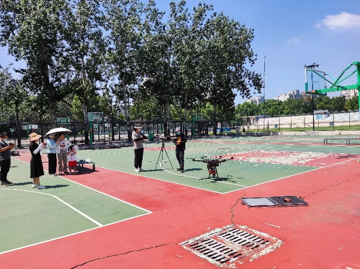
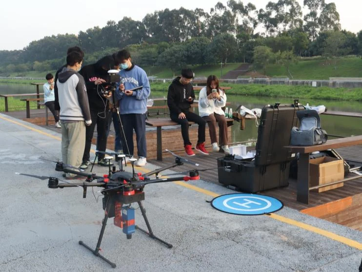
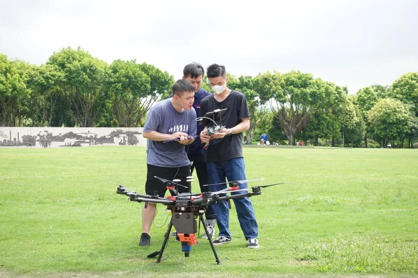
VNIR Platform Field Examples
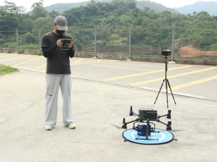
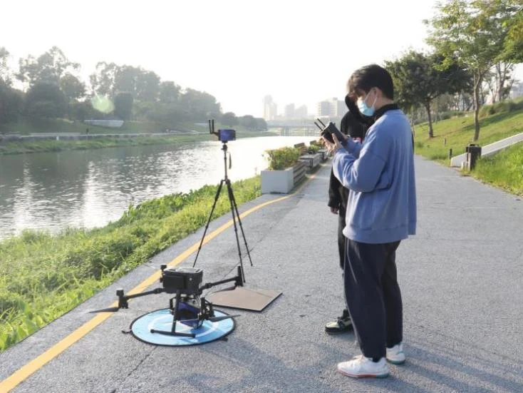
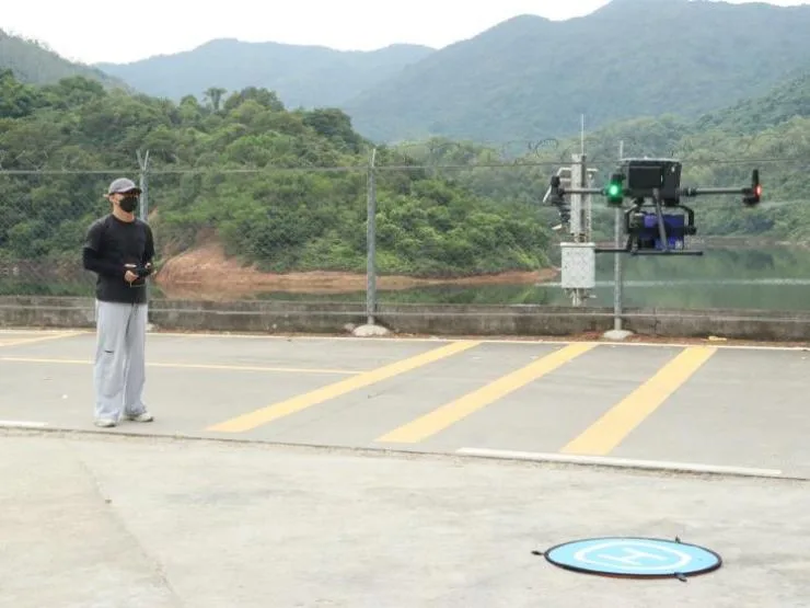
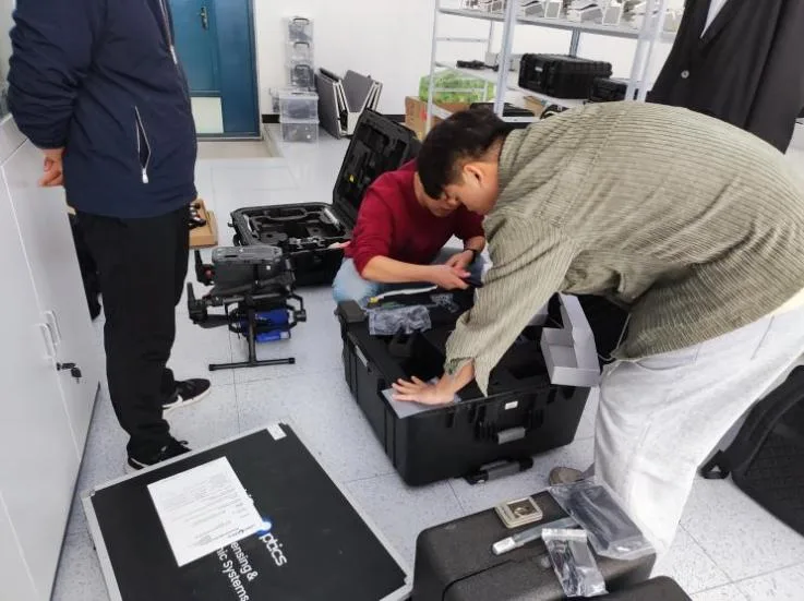
Explore the UAV hyperspectral imaging system range for related airborne instruments.